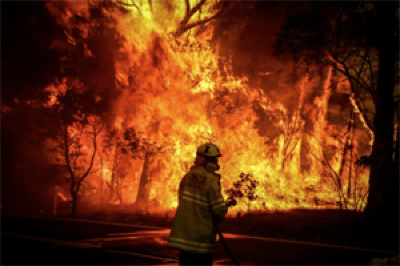
When I saw on the news the aftermath of the tragic wildfire that killed more than 100 people and destroyed over 2,000 buildings in Lahaina on the island of Maui, Hawaii, I was upset — but also frustrated. It brought back memories of my research trip to Paradise, California, to document damage there caused by the 2018 Camp Fire, which killed 85 people and destroyed more than 18,000 structures.
Driven by drought, high winds and extreme heat, fires in recent years have caused destruction and losses on a scale bigger than anyone is used to. The average annual global cost of wildfires is around US$50 billion, the World Economic Forum said in January. And by the end of the century, climate change might make catastrophic conflagrations 50% more common, according to the United Nations Environment Programme. Given the surge in urban development in and near forested areas, something has to be done to protect communities. As Maui’s experience shows, little is in place.
Communities and policymakers desperately need strategies to mitigate losses from wildfires. The starting point must be to improve understanding of what causes wildfires and wildfire damage.
Hawaii wildfires: did scientists expect Maui to burn?
Wildfire risk depends on two factors: the chance of ignition in wildlands and how fire propagates into and damages the built environment. The first is reasonably well understood. The second is not (J. K. Shuman et al. PNAS Nexus 1, pgac115; 2022). And there is no connection between how fire risks are managed in the two environments.
Most wildfires are started by human activities, such as discarding cigarettes, or by power-line failures. The latter might have caused the initial spark in the 2023 Maui fire, and did in the Camp Fire. The likelihood of a serious fire developing depends on how dry the soil is, whether there are lots of plant roots in the area and the flammability of surrounding vegetation or debris.
Strategies for managing natural fires in wildlands are proven — if not always practised. Small fires can be suppressed by using fire retardants and thinning or pruning vegetation.
Predicting damage to the built environment is much harder. Each community differs in its layout, materials used and vegetation. Fires can transmit through flames or radiation and feed on a range of fuels. Embers in the air can ignite roofs or pass through vents and windows.
There are helpful steps homeowners can take — homes can be ‘hardened’ with fire-resistant roofs, decks, eaves and windows, for example, and buffer zones can be made by clearing combustible vegetation.
But community-wide mitigation would be more effective. Computer models take a lot of processing power, and planners and policymakers are not yet using them to understand the behaviour of wildfires in towns. But such models can capture the transfer of heat and how it interacts with vegetation and buildings under specific wind conditions. They could allow officials to understand, for example, how hardening one home or removing one tree would affect the vulnerability of another home or tree down the road. My own modelling has reproduced, with reasonable accuracy, the damage to buildings caused by the Maui fire, the Camp Fire and the 2021 Marshall Fire in Colorado (A. Chulahwat et al. Sci. Rep. 12, 15954; 2022).

Australia’s massive wildfires shredded the ozone layer — now scientists know why
Strategies for hardening communities must be coupled with those for managing wildland fuel. For example, which vegetation is thinned or pruned will affect which homes should be made more fire resistant, and vice versa.
A connected view of vulnerability and risk is familiar from management of other natural hazards. For example, seismic risk is determined by combining the probability of an earthquake with the likelihood of damage to a building. Seismic hazard maps and tools for addressing design vulnerabilities in key buildings such as hospitals are used widely.
Better models of propagation and damage are just a first step to managing wildfire risk. The approach won’t work without better data on the built environment in fire-prone regions, including information on roof materials, cladding types and the sizes and locations of windows. Collecting such data is an enormous task; my team is exploring using machine learning to extract it from online maps using image recognition. Wind data at the level of a single building and data on how extreme heat affects air flow will also be needed to predict vulnerabilities accurately. Such information might be collected in the field, through wind-tunnel testing or with fluid-dynamics simulations.
How climate change will alter ignition likelihood, wind conditions and vegetation characteristics must be clarified through simulations and observational data. Solutions will need to be reassessed and updated periodically. And the social complexities of fire-risk management need to be understood. Studies must examine, for example, whether people who live near fire-prone vegetation should pay more for mitigation, or whether the entire community should pay, given that everyone benefits. How can residents pool their resources to reduce the abundance of a particular fuel or harden specific homes? How can consensus be reached?
These hurdles are surmountable, and I have hope that researchers will help policymakers and community leaders to adopt a risk-based approach to reduce wildfire losses.
Competing Interests
The author declares no competing interests.